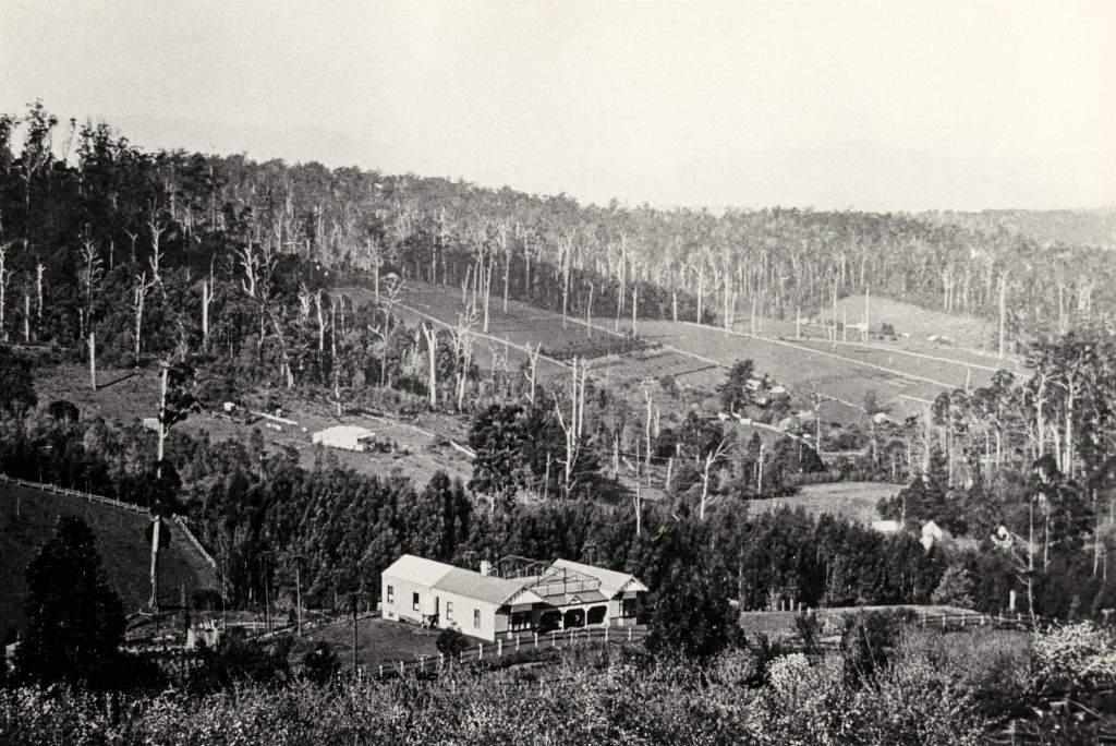
View of the settlement of Harmony Vale taken in 1913 with the guest house Kia Ora, built by George Barber in 1909, in the foreground. This photograph has a detailed inscription on the back handwritten by John Lundy-Clarke.: The settlement of Harmony Vale 1913. The large home in foreground is the Guest House Kia Ora owned by George Barber on Lot 25 of the Village Settlement. The house above it to the left was Richardsons house. The home of Jeanie who had left it when the picture was taken.The buildings furthest to the right of Kia Ora were the homestead of Isaac Jeeves of 1863 1871 the building furthest right with the black opening in it was the house with the tree fern floor. The flat ground above and left of Isaacs pointed roof barn is where the creek changed its course in the 1934 flood and destroyed ?4000 worth of the Rowse familys tulip bulbs. Above the flat is Francis Matthew Childs homestead, in the creek to the right of which can be seen the horizontal structure of the swing bridge to the sawmill of the Childs Bros which cannot be seen but in the forest to the right of the mill (bridge) can be seen a number of logs in the mill yard. The two cleared strips immediately behind Childs home were the Richardsons original holdings and the house in the gully at the far side of the great clearing is that of the guest house Glenrivers belonging to W Lucas and his wife Catherine nee Child. The Richardson homestead Harmony Vale is behind the forest trees in the right centre. The picture gives a full view of how the settlement was cut into the centre of the great forest.
Make:unavailable
Model:unavailable
Image Orientation:unavailable
Image X Resolution:96
Image Y Resolution:96
Image Resolution Unit:inch
Image Date Time:1/06/1913 12:00 PM
YCBCR Positioning:Centered
Exposure Time:unavailable
F Number:unavailable
Exposure Index:unavailable
ISO Speed Ratings:unavailable
Shutter Speed Value:unavailable
Aperture Value:unavailable
Focal Length:unavailable
GPS Altitude:397.077
GPS Latitude:-37.824848
GPS Longitude:145.367835


